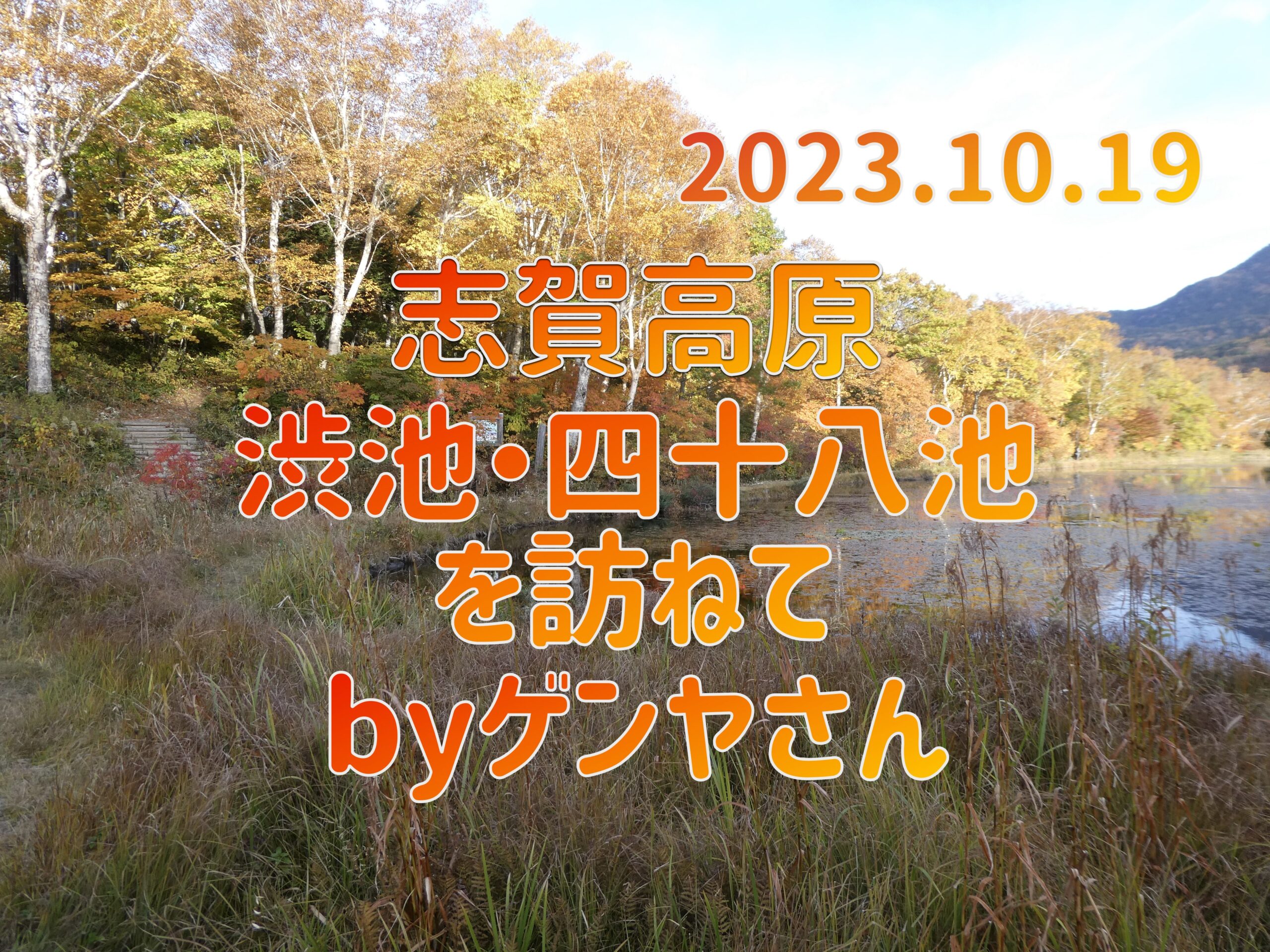
2023.10.19 Visiting Shibuike and the 48 ponds of Shiga Kogen by Genya
HokkaidoMarshland Visit ArticleGenya, who posted this, visited Shiga Kogen in the depths of autumn and wrote an account of his exploration.
Now, please enjoy Genya's article!
table of contents
Introduction
October 19th (Thursday), sunny
The marshland turned brown and, as its glamour faded, the crowds of people disappeared.
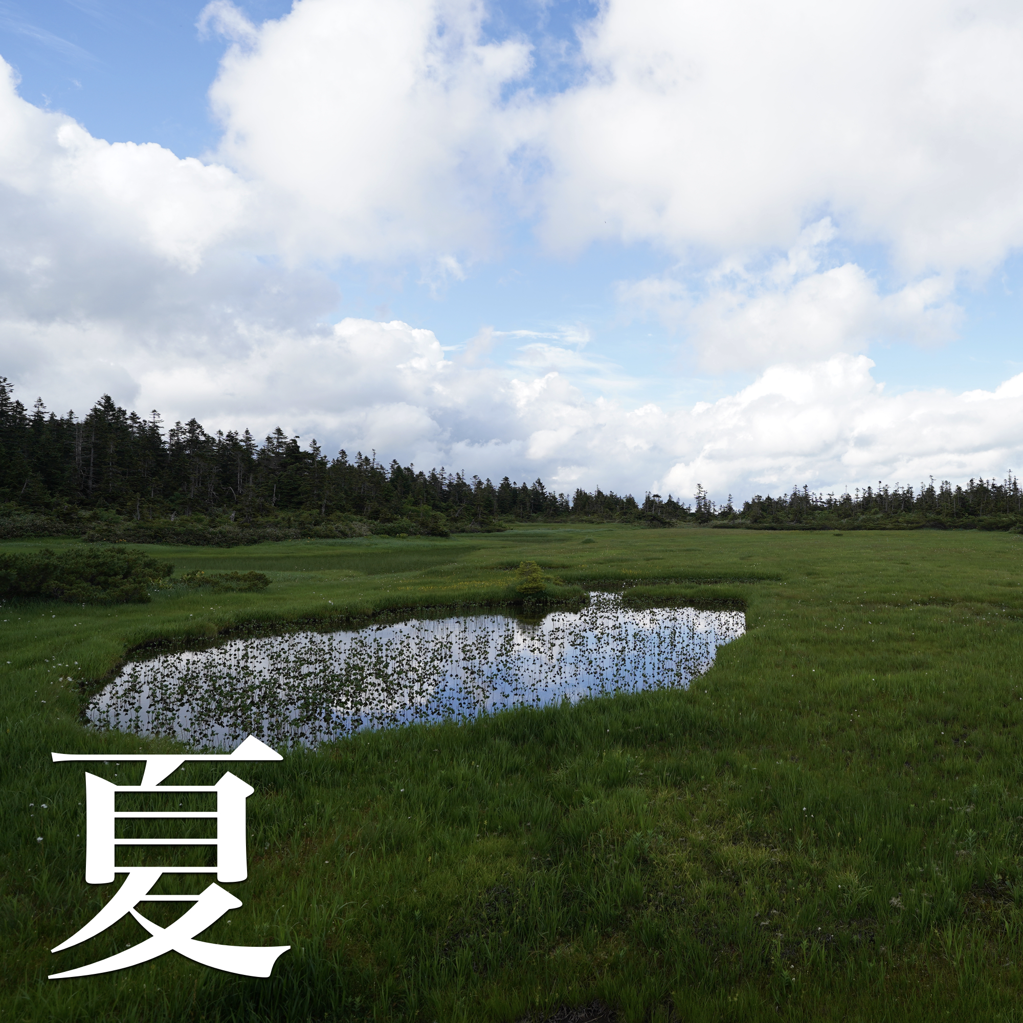
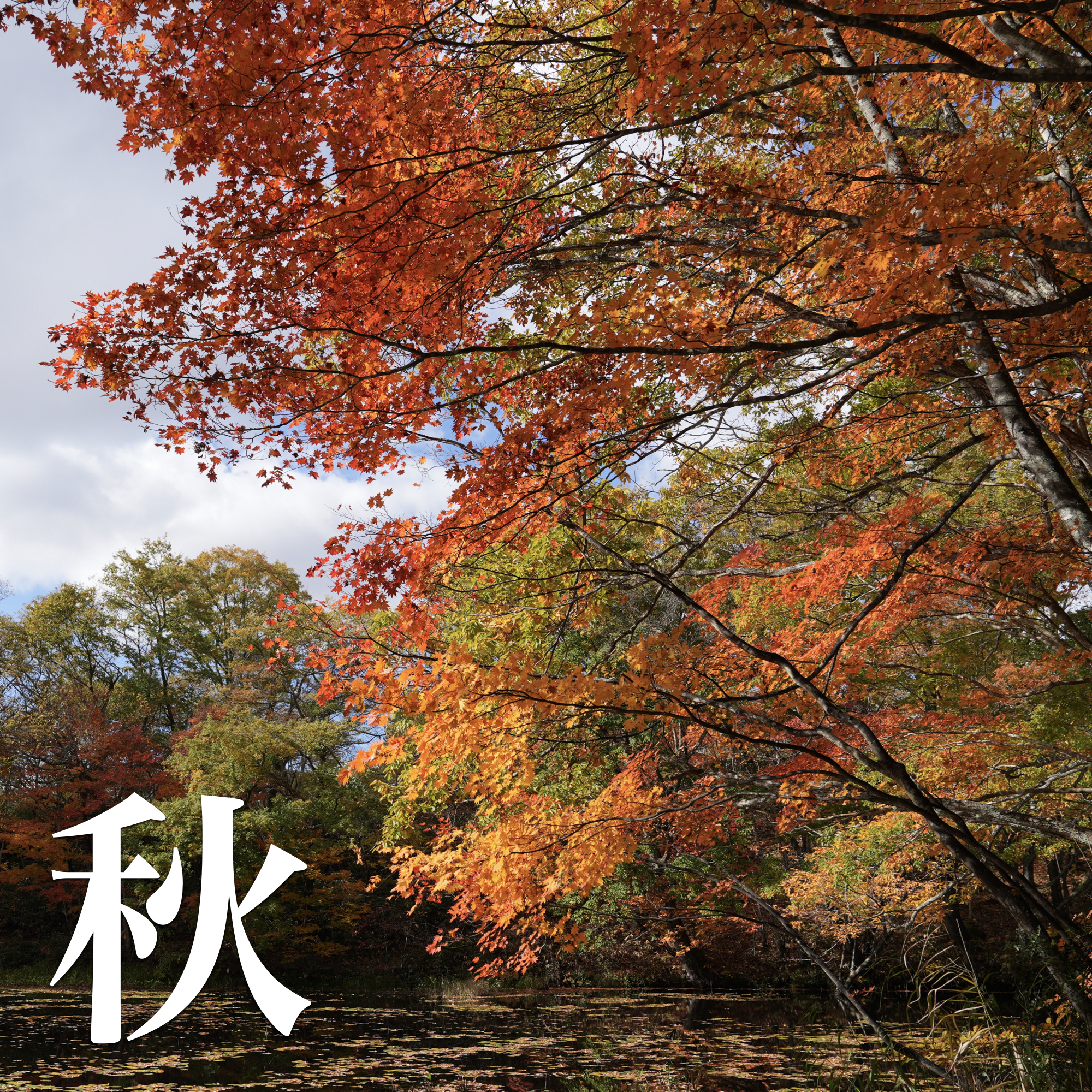
I went to see the autumn leaves at Shibuike, Forty-eight Ponds, and the plateau of Shiga Kogen, which was deserted for about a month and a half before the snow fell.
At an altitude of about 1,000m, leaving the hot spring town where the summer scenery still lingers, we came upon a winding mountain road where the leaves of broadleaf trees such as beech and oak were beginning to turn yellow.
Furthermore, at an altitude of 1,500 m, where the lotus pond is located, the leaves had already begun to change color.
At higher altitudes, the autumn leaves of Betula ermanii stood out among a forest of conifers such as L. marigold, L. diversii, Thuja umbellata, and Picea japonica.
The Shigayama area is a volcano formed by an eruption about 250,000 years ago, and water has collected in depressions on the surface of the lava, forming Biwaike, Hasuike, and Maruike ponds.
Lake Onuma was formed by the damming of lava flows.
There is a pond formed in the crater.
The marshes include the Shijuhachiike Marsh, which formed at the top of the river, and the Maeyama Marsh, which was formed in a lava depression, and although they all now make up precious natural sites, they seem to have had various origins.
I walk around looking around.
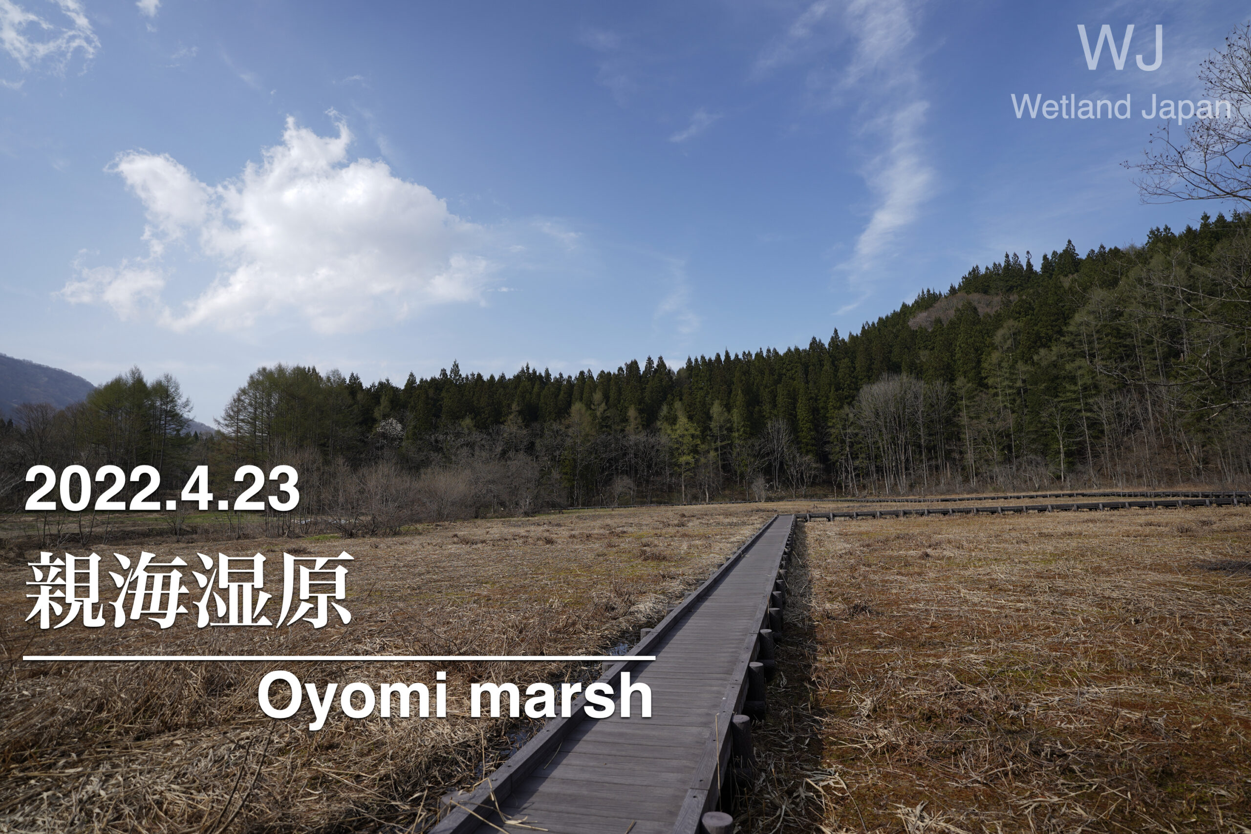
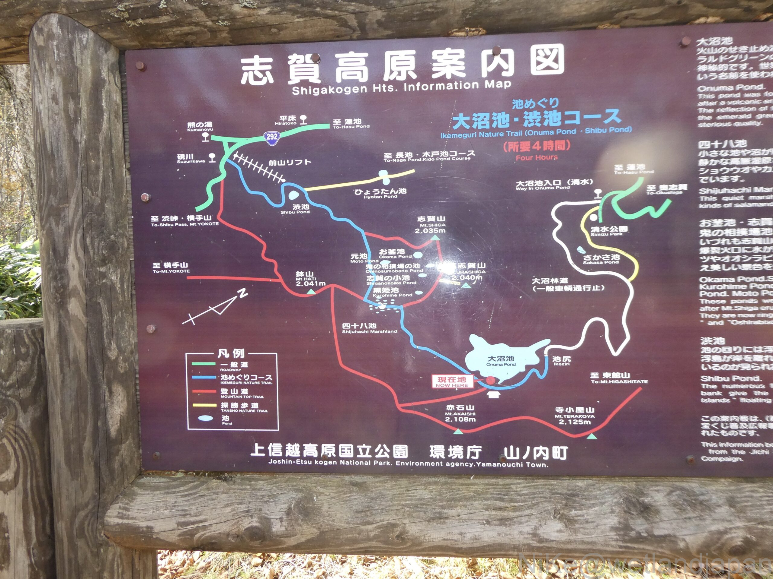
This time, we toured the marshes and ponds of Shiga Kogen, walking along the blue → white → yellow course from Suzurigawa River.
From the entrance to Onuma Pond, we entered Shimizu Shindo (not shown on the map) and headed out to Shinshu University Botanical Garden.
The trees all the way up to Yudanaka, on the outskirts of Nagano City, are green.
As we went higher the colour of the leaves changed, and at Maruike and Hasuike ponds, at an altitude of 1,500m, the leaves were beginning to turn red.
By next month the leaves will have fallen and only the trees will remain.
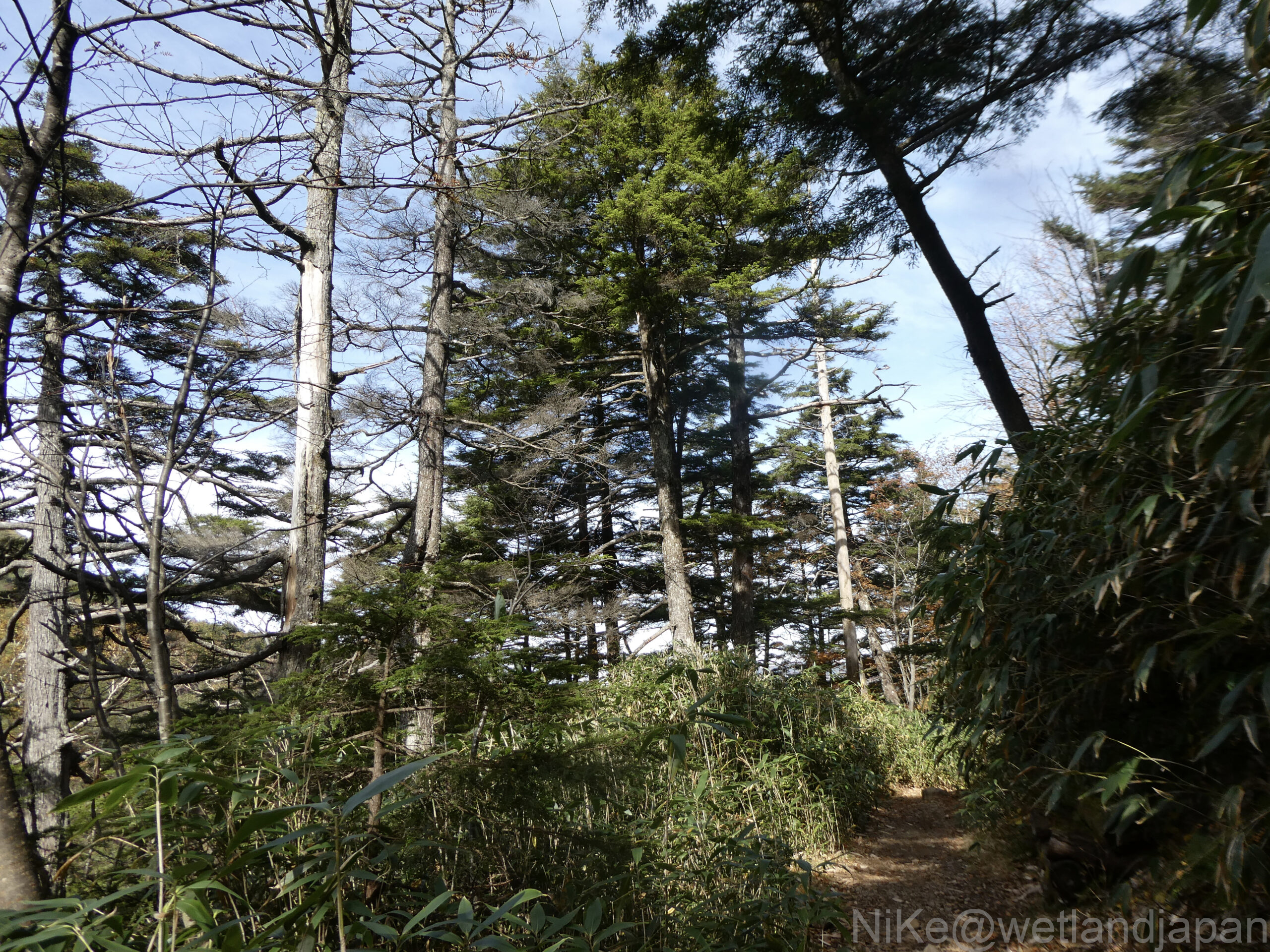
Near the top of the mountain is a green coniferous forest.
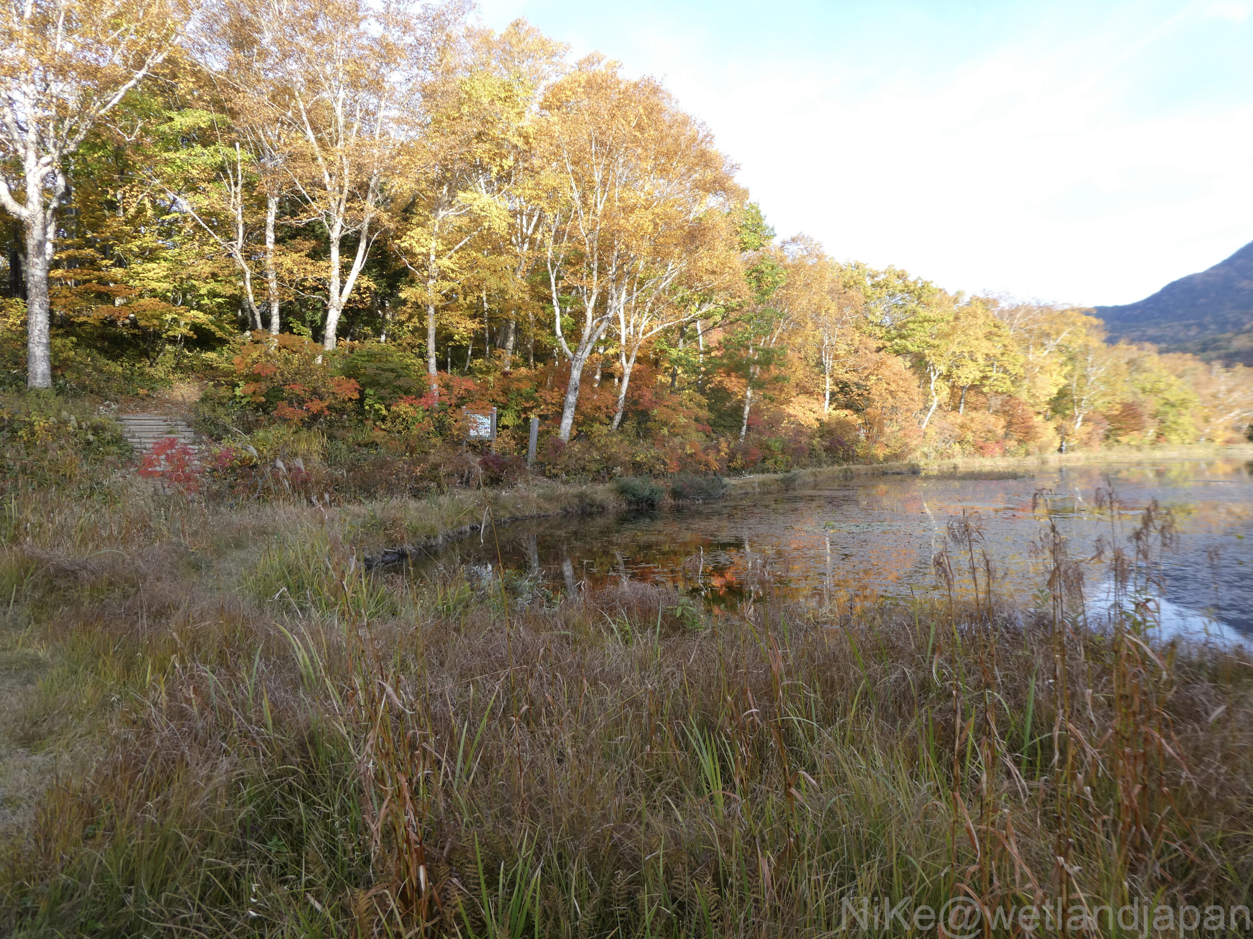
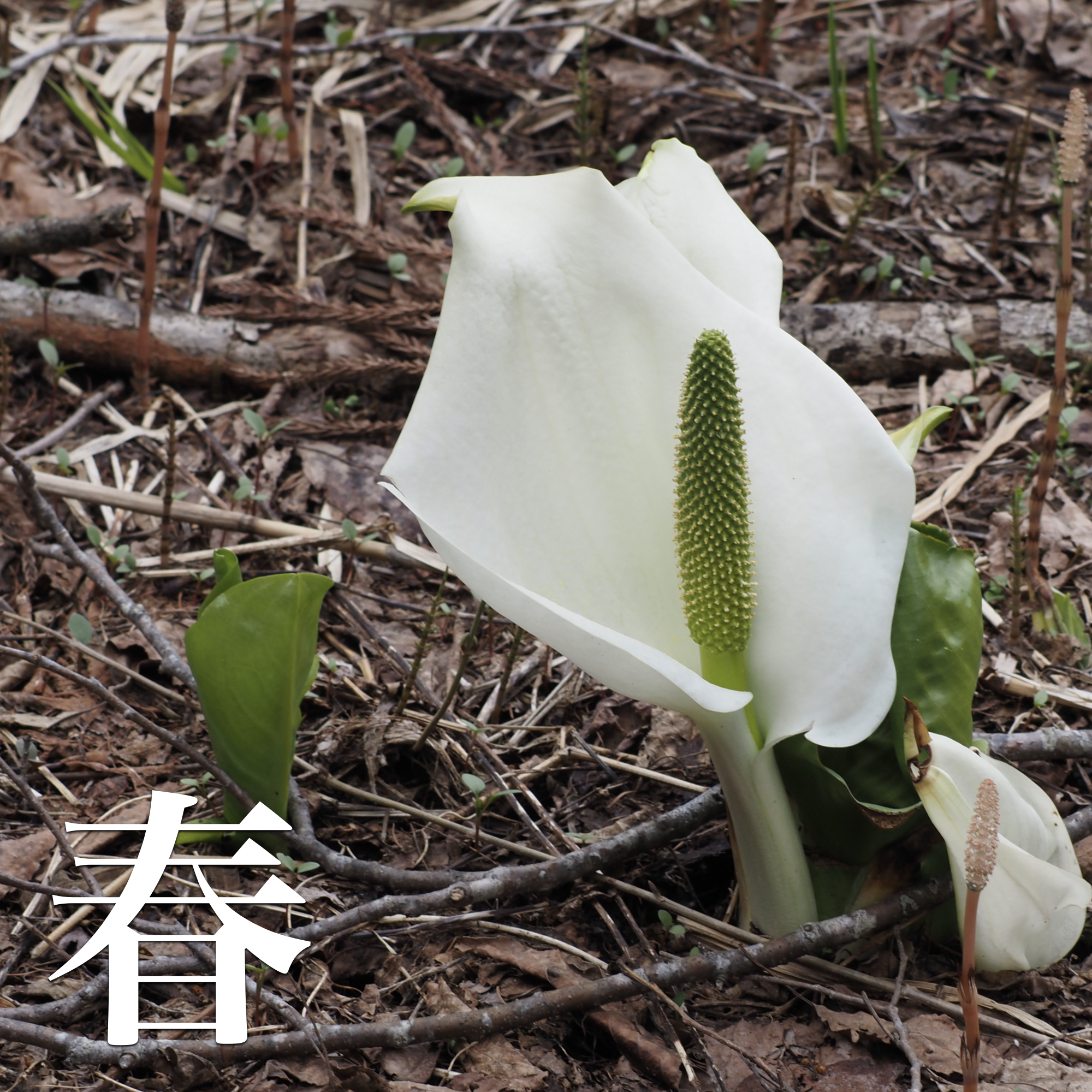
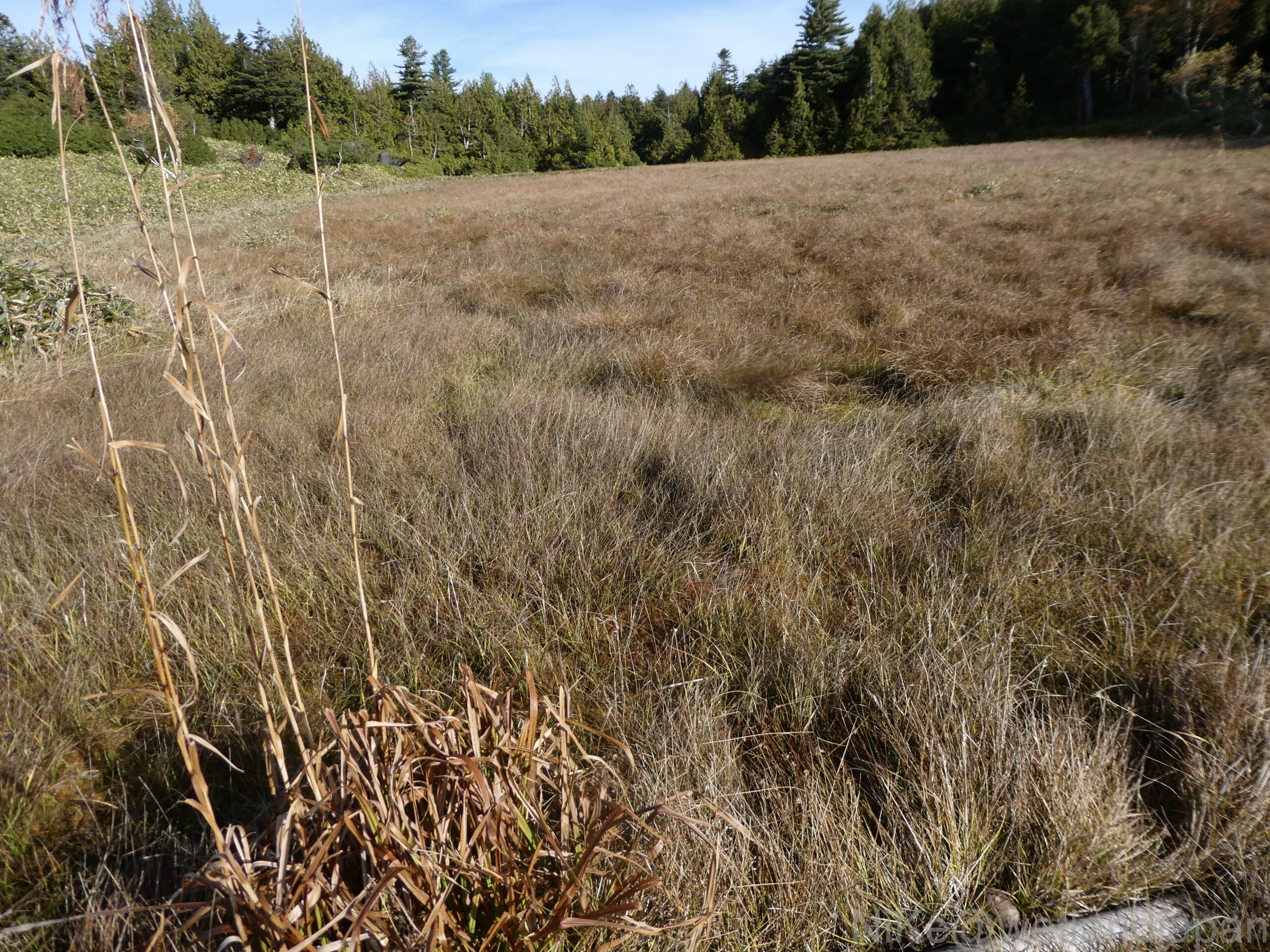
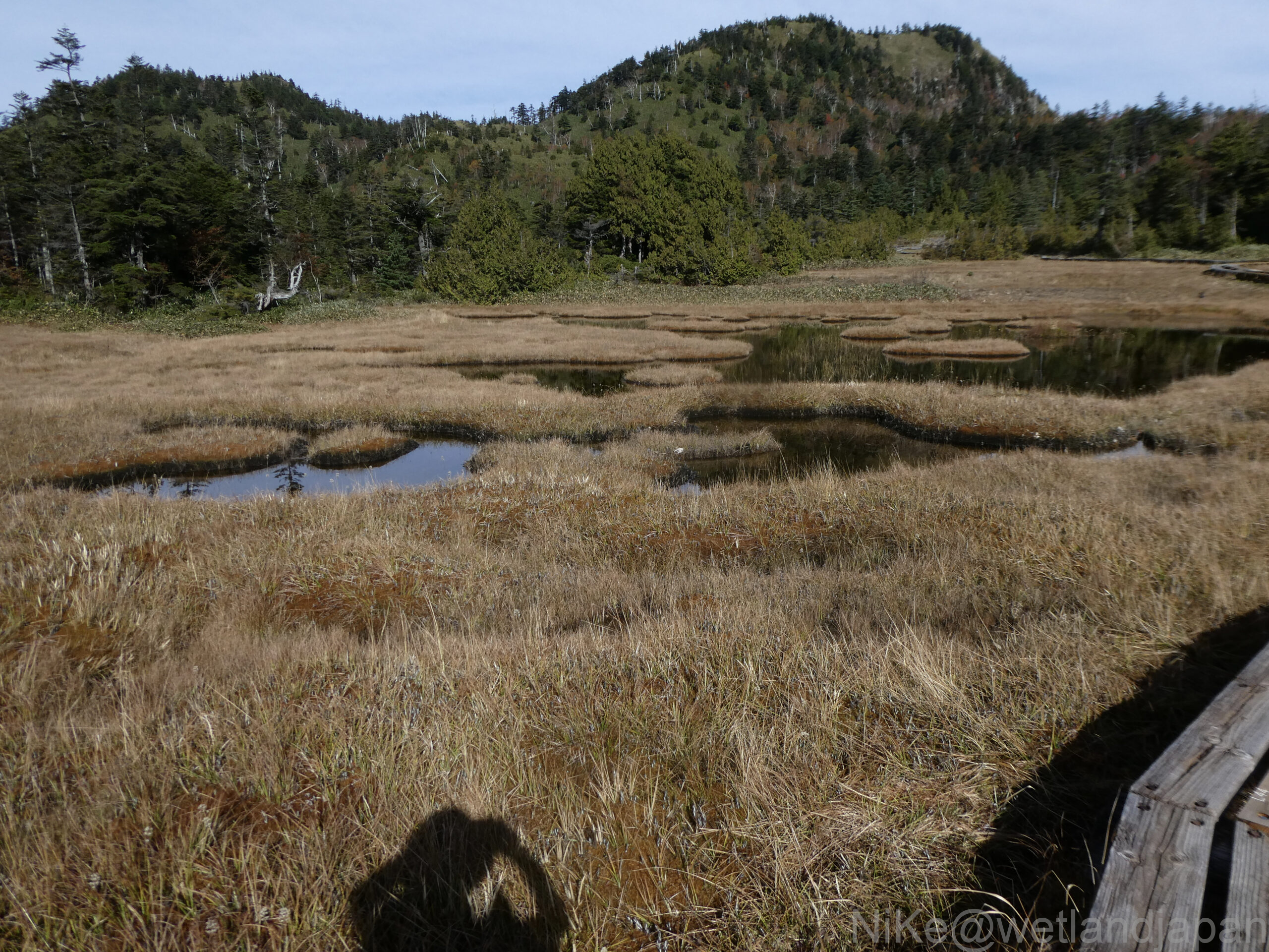
The white flowers of the cotton grass have faded, and the plains are covered in the brown of maples.
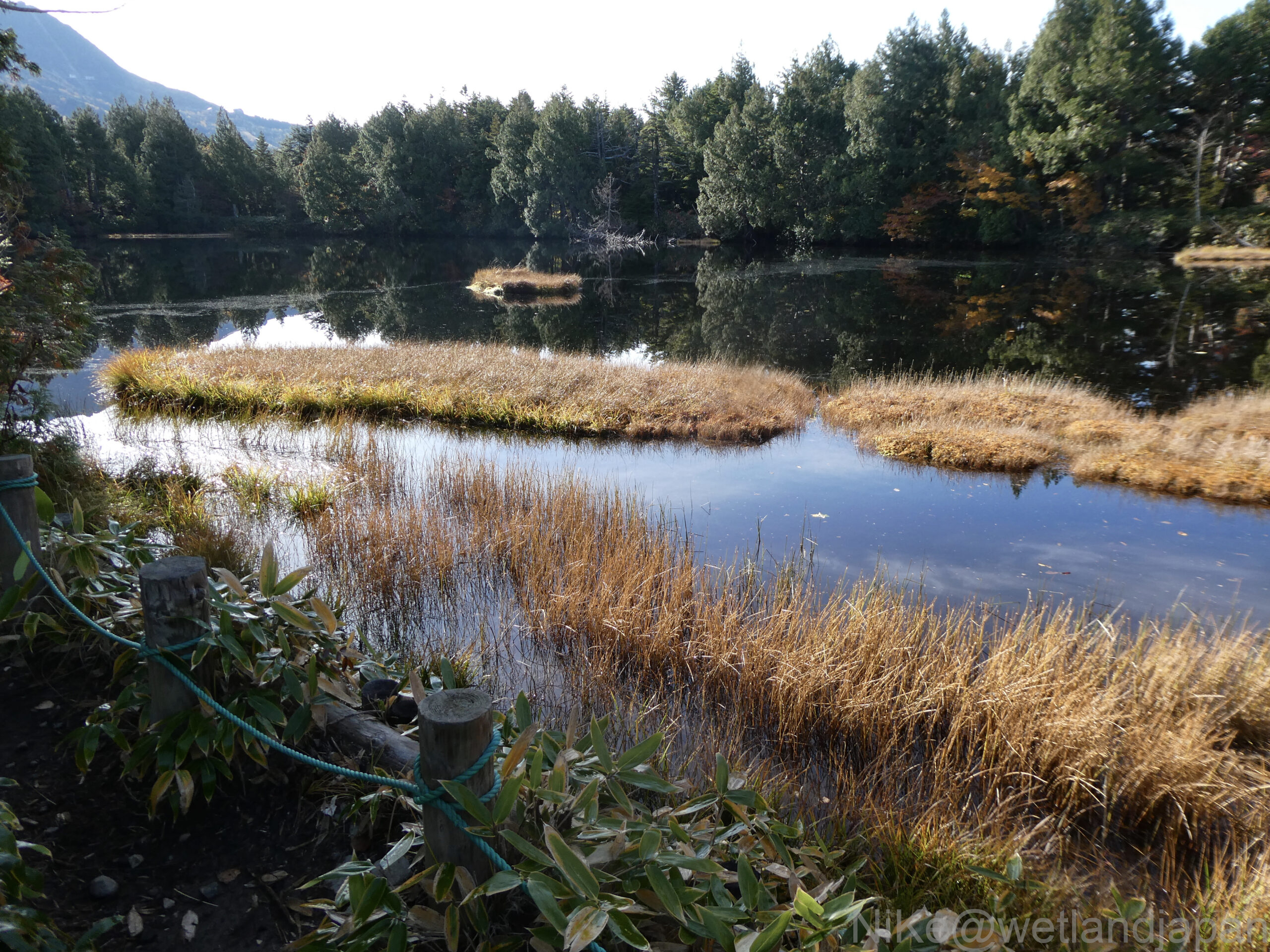
A high moor with floating islands dotted around a pond in a forest of coniferous trees such as silver fir and tsuga diversifolia.
In summer the top of the floating island is green but now it is brown.
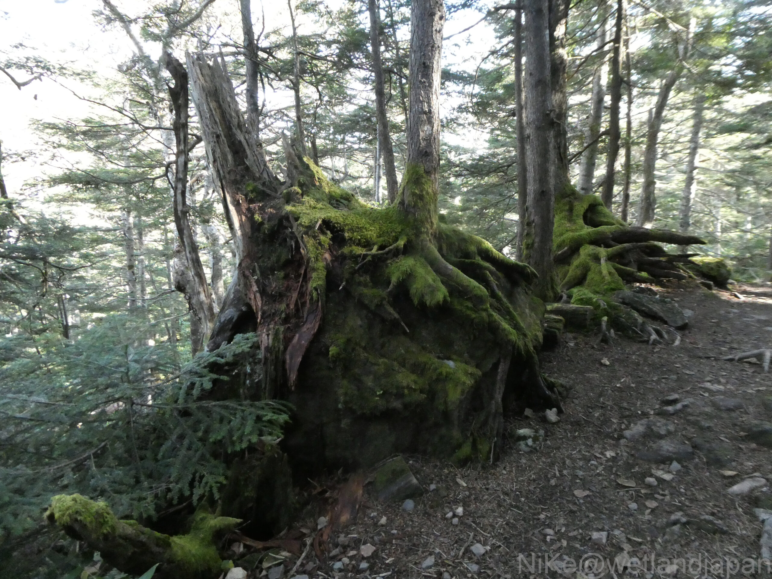
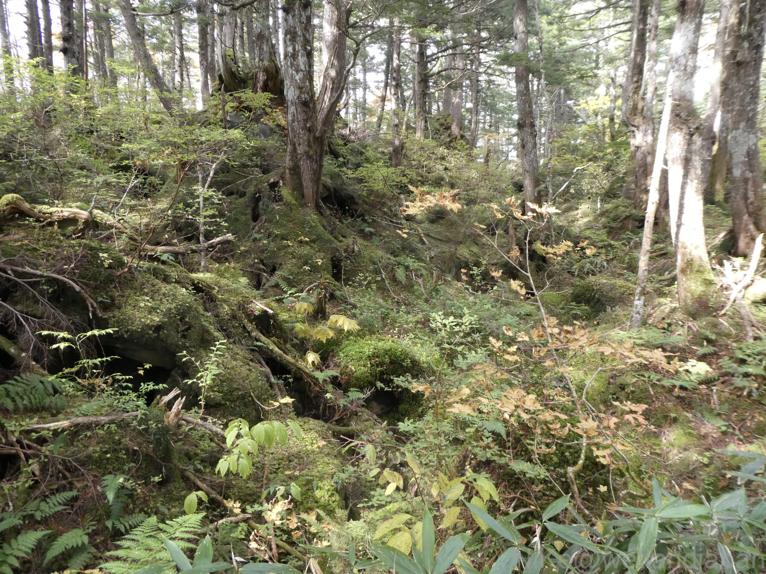
There is a lot of moss around the roots of the old tree.
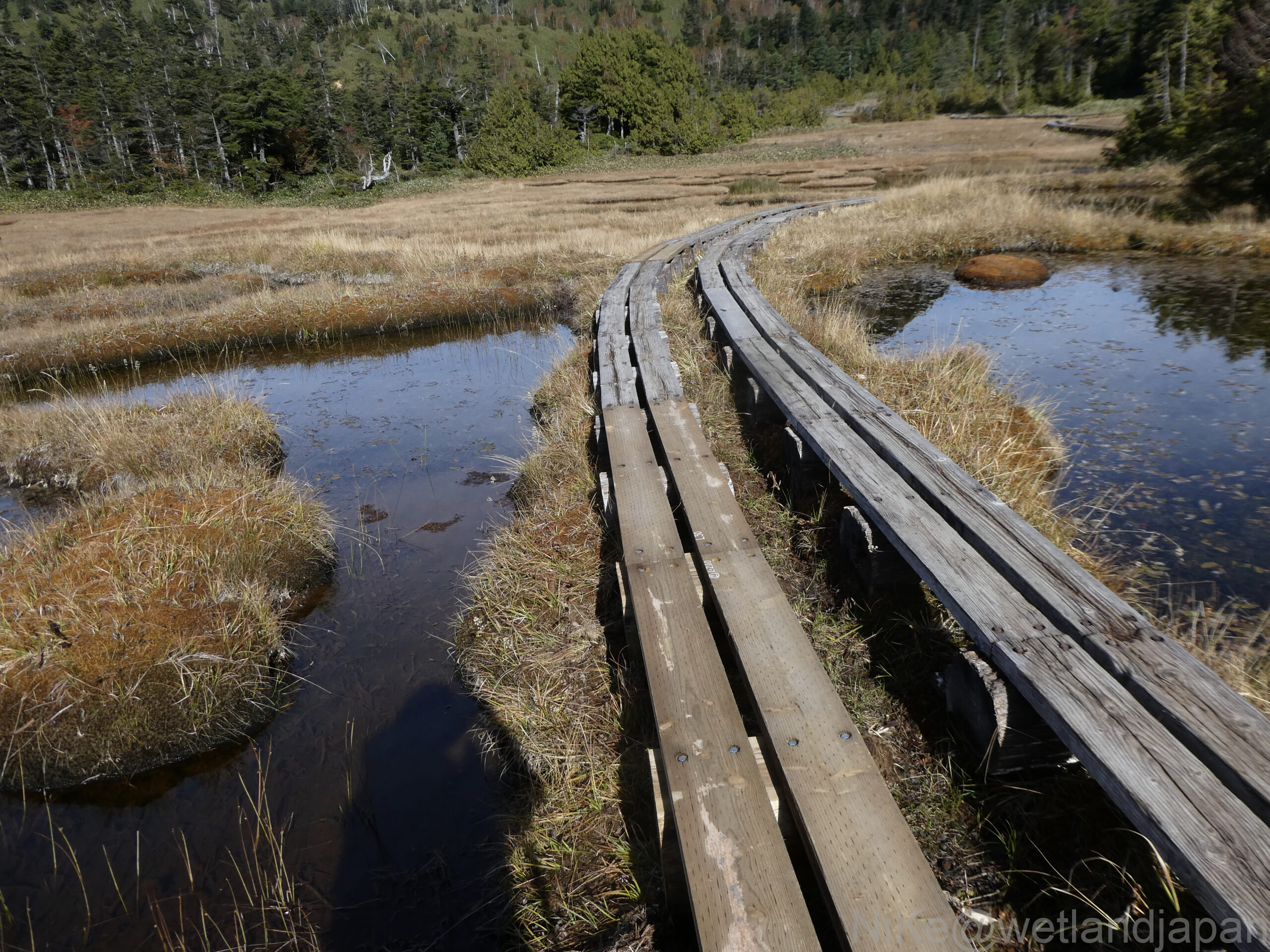
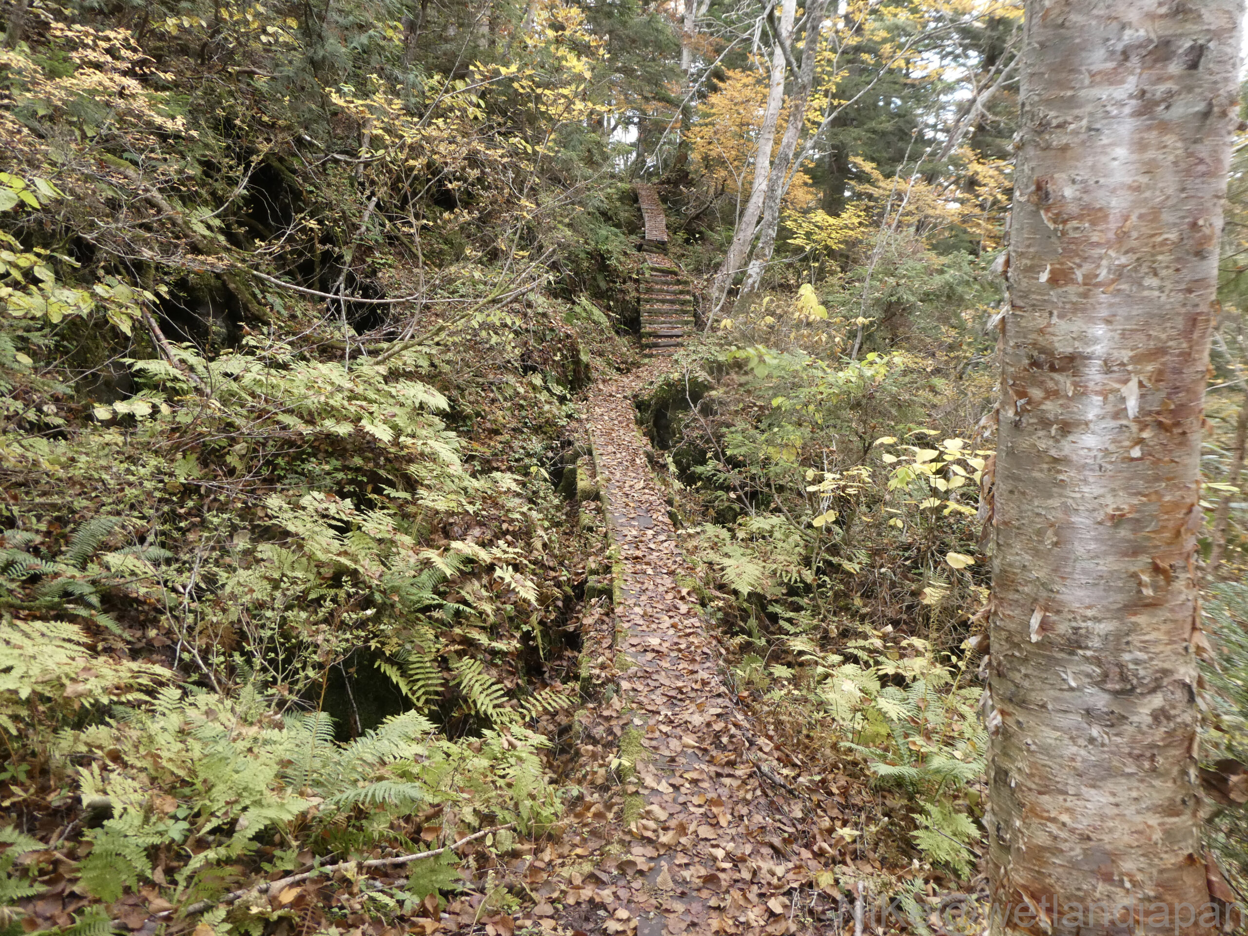
A boardwalk runs through the marshland of ponds and floating islands into the forest.
Here, the boardwalk is made of logs as a base and boards nailed to it, and it seems there are various ways of making it. The rotten boards were replaced with new ones.
Water collects in a depression surrounded by mountains and turns into a marsh.
To the left of the Camel's Hump Mountain in front is Shigayama, and to the right is Ura Shigayama.
The marsh is completely brown, whereas a month ago it would have still been lush and green.
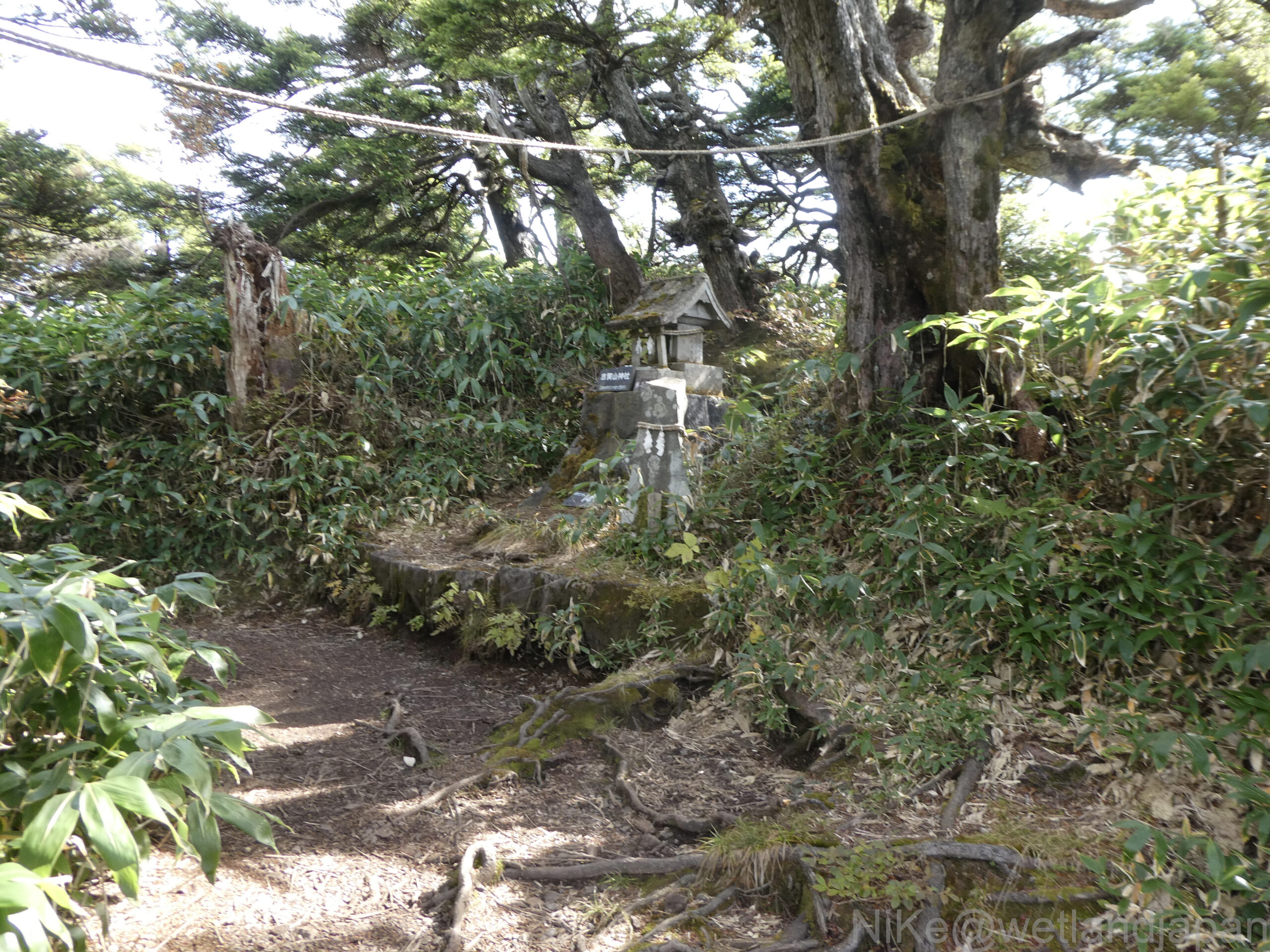
Beyond the 48 ponds is Mount Urashiga.
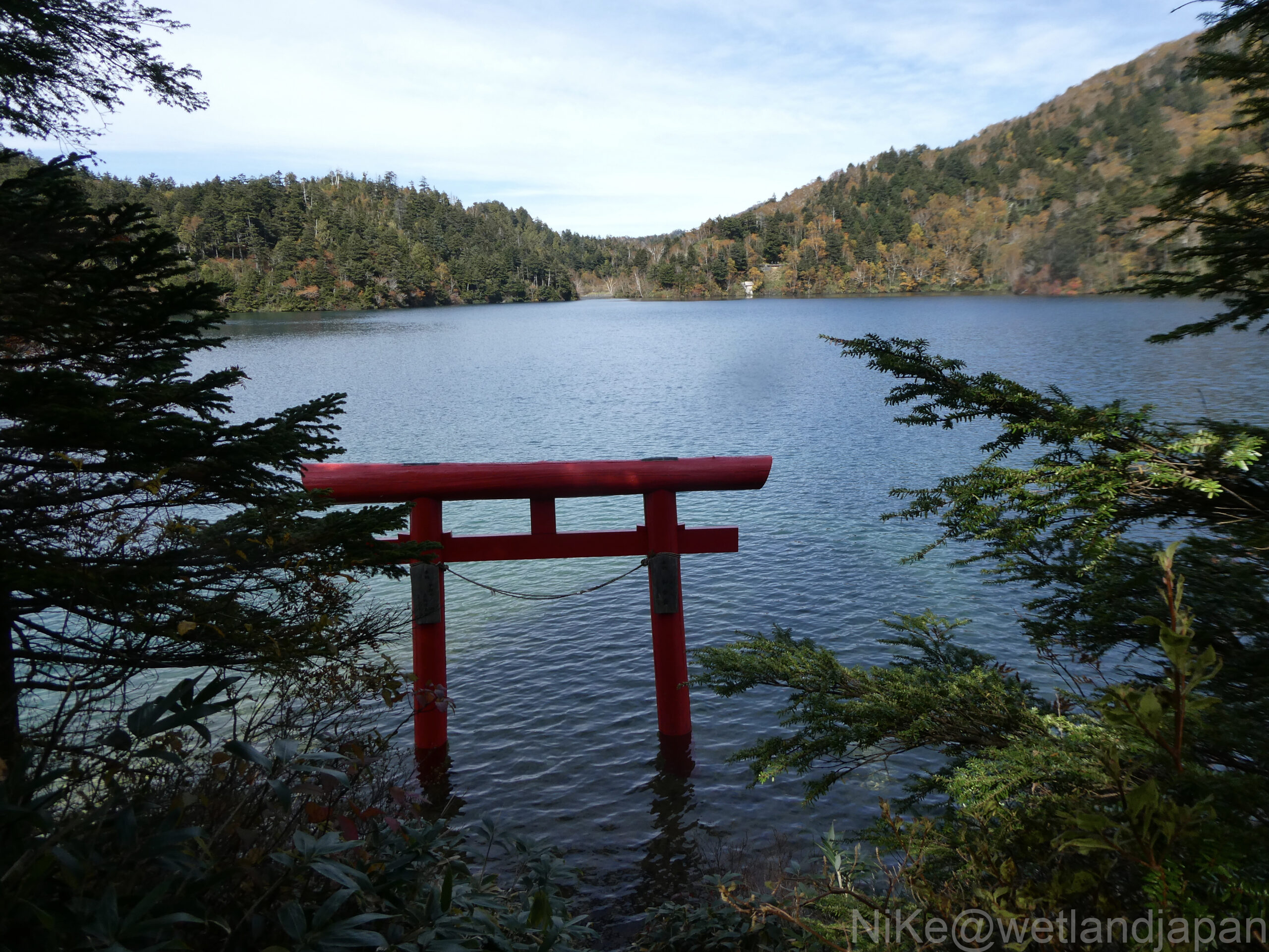
At the top there is a small stone shrine with the words Shigayama Shrine written on it.
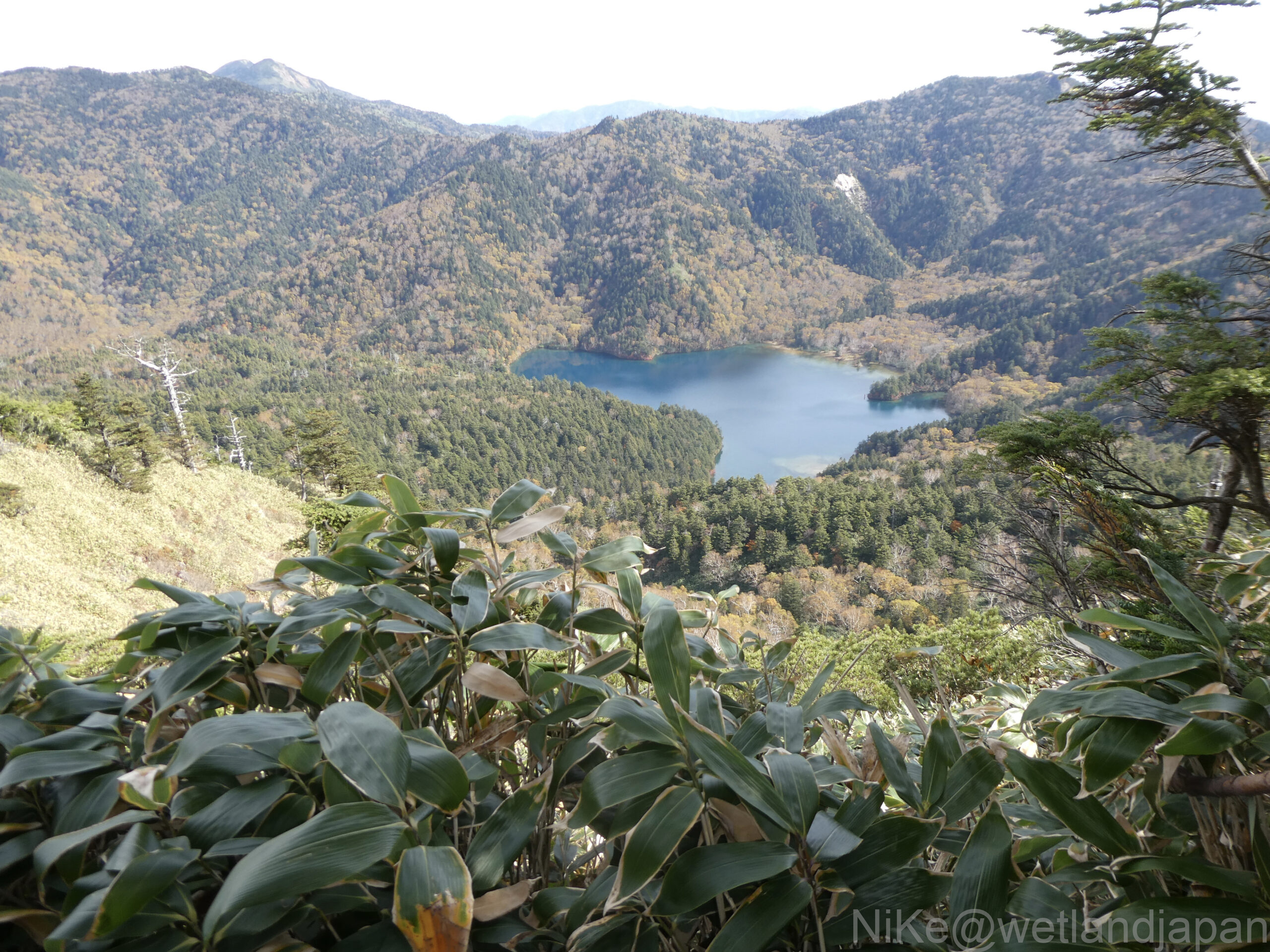
When you look down from the top of Urashigayama, the first thing you see is Onuma Pond.
This is the largest pond in Shiga Kogen and is surrounded by mountains.
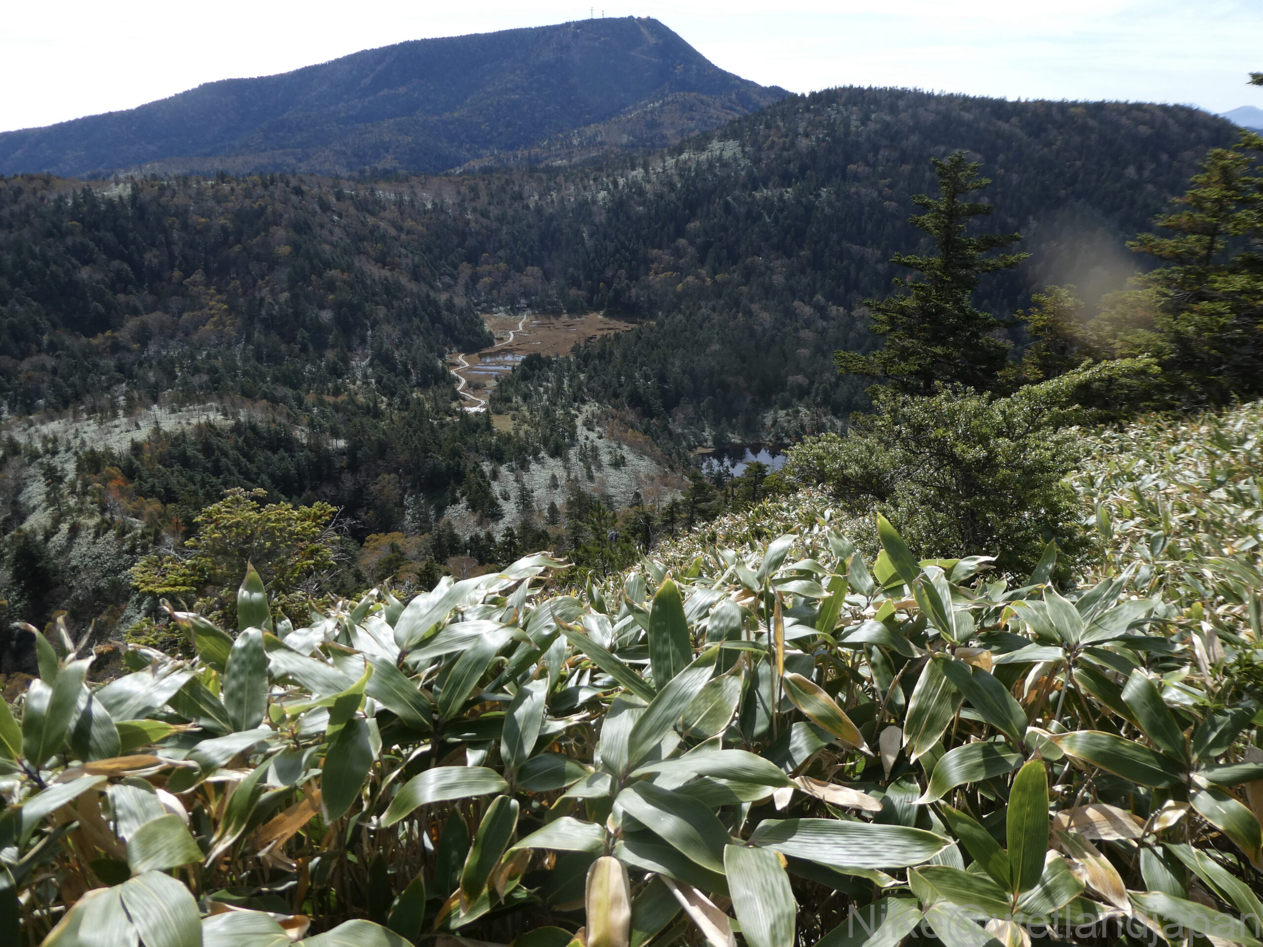
If you look to the right, you can see the Forty-Eight Ponds, which you just walked through.
It's the brown part slightly to the left and above center.
Located in a depression in the mountain, it is completely surrounded by trees and appears narrower than it looks from below.
Along this walking trail, large trees were thriving everywhere.
They have survived in a climate where winter temperatures can reach as low as -30°C.
I believe the tree in front of me is a spruce, but how old is it?
Lake Onuma is a lake located at an altitude of 1,694 m, 26 m deep, and has a circumference of 5 km.
The andesite lava flow that flowed northeast from Mt. Shiga dammed the Yokoyu River, creating Lake Onuma, and the area above the lava flow became a subalpine coniferous forest (primeval forest).
A highly acidic mineral spring containing sulfate ions springs out from Akaishizawa, which flows from Mount Akaishi.
That's why it's a beautiful cobalt blue.
There are no fish living in Lake Onuma.
According to the Ministry of the Environment's 1991 lake survey, the lake's transparency is 13.5m, the highest in Nagano Prefecture and ranked 6th in Japan.
A little further back from the entrance to Onuma Pond.
Trees thrive even on rocks.
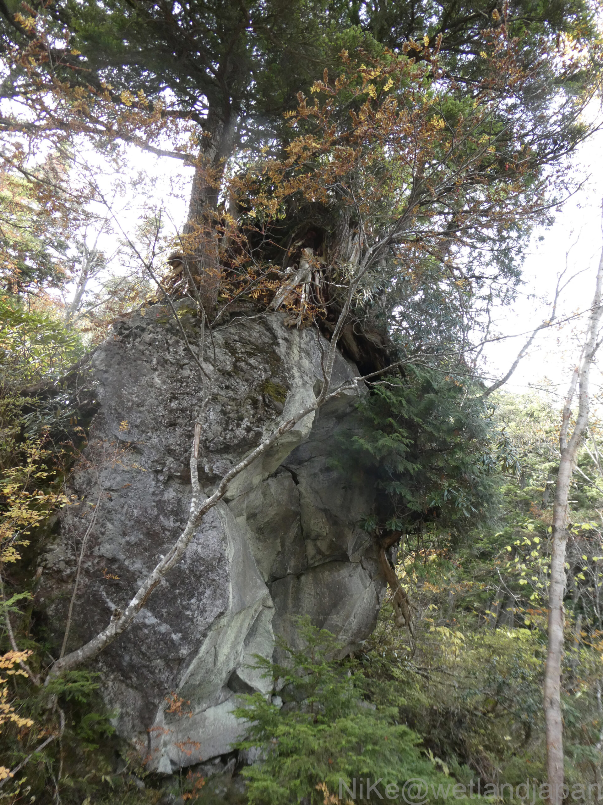
A dense forest of moss and conifers has formed over many years on top of the lumpy rocks of lava flows.
There are holes here and there that are thought to be traces of lava flows.
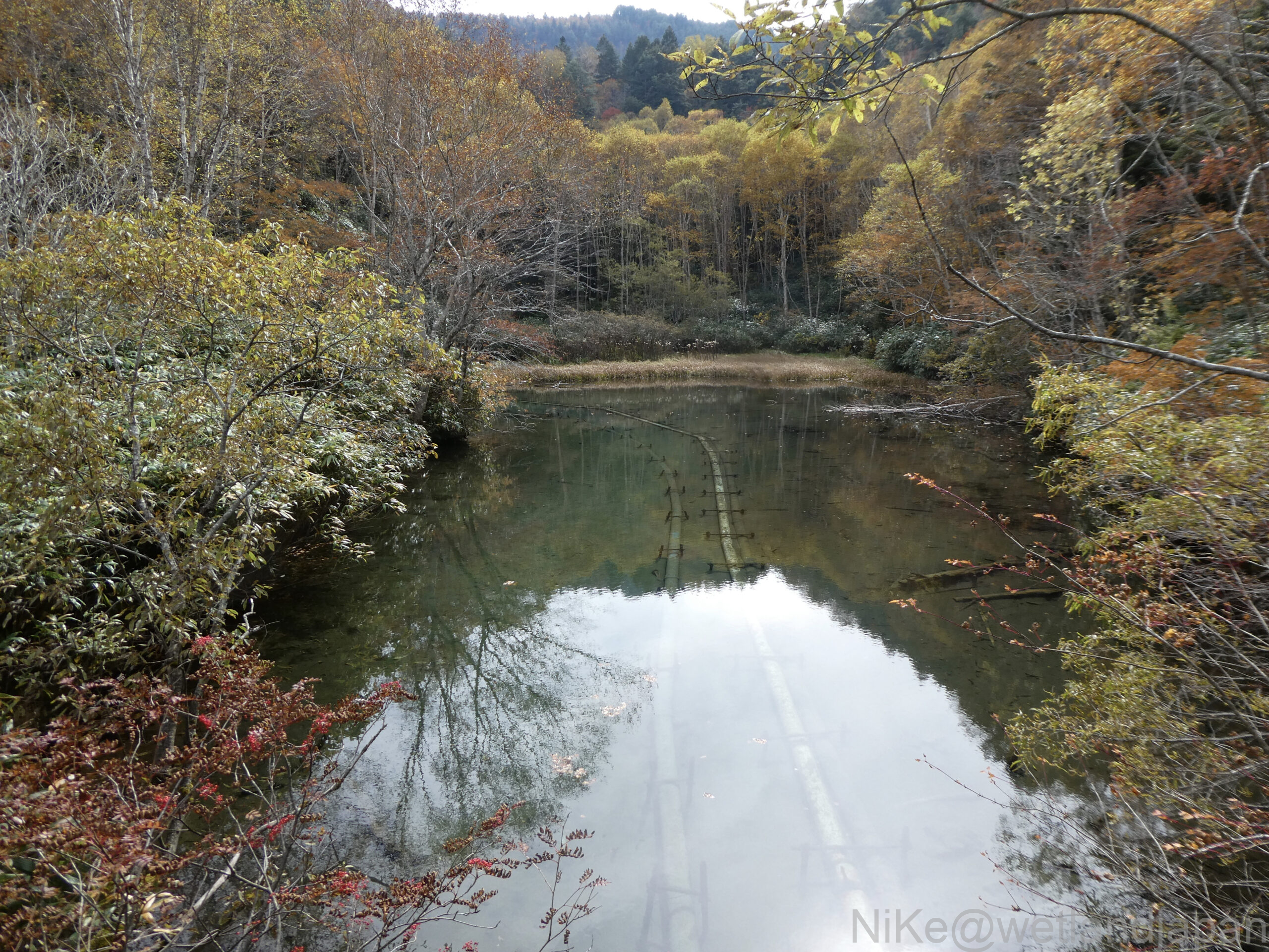
Downstream from Ikejiri in Lake Onuma, the depression has become a pond.
There are two pipes laid at the bottom of the pond, but I wonder what their purpose is.
From the entrance to Lake Onuma, a boardwalk connects the steep slopes, crosses the Jaint Ski Resort, and leads to Nagaike Pond next to the Shinshu University Botanical Gardens, a path carved out of the primeval forest.
This was the most densely forested path of the day. Be careful when choosing a route next to the ski resort.
Afterword
There were few pedestrians and it was a quiet stroll.
Departed from Sumiregawa at 7:40...arrived Hasuike at 14:16.
14km, 590m ascent, 800m descent, 6:40 walk
Until now, my image and scenery of Shiga Kogen was first of the hot springs, then skiing in the winter, and getting off at the lake beside the national highway to look at the surroundings.
This time, we took a walk through the marshland to examine the topography and vegetation, and even walked through part of it.
A walking path was built beside the paved road through the coniferous forest and marshland, and there were few man-made objects.
I feel like I was able to experience nature better than I had anticipated.
At Shibuike and Forty-Eight Ponds, we were able to see the ponds and floating islands right before our eyes, and it was certainly true that "wet grassland = marshland, in which the establishment of forests is prevented."
Where does it fall in the "wetland" classification?
Maeyama Marsh has become dry, likely due to a lot of soil and sand seeping in, so it may be a "wet grassland."
We spent half a day walking through a dense forest of subalpine conifers, including spruce, hemlock, mariesii, and thrush, which can be seen from the hiking trail. We were impressed by the trees' tall height, thick trunks, and tenacity, with roots that spread even over rocks.
May this nature remain forever.
※Explanation of Onuma Pond: Source: Shinshu STYLE Onuma Pond
About the Reader Submission Project
This site welcomes readers' exploration records.
If you are interested, please contact us via the following page!